Remote Sensing
2013 — ongoing
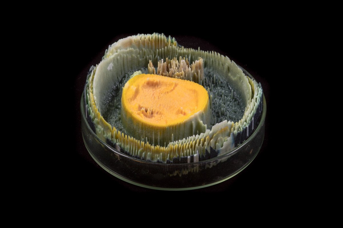
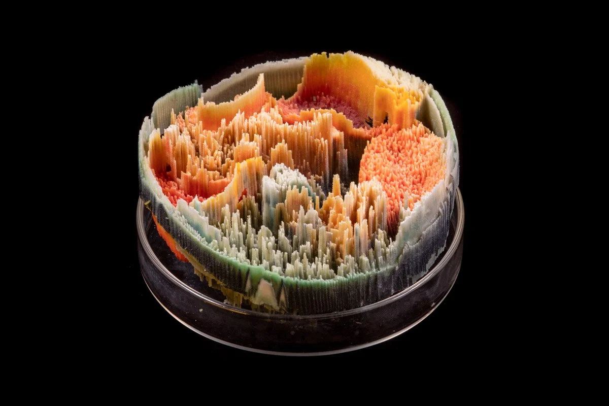
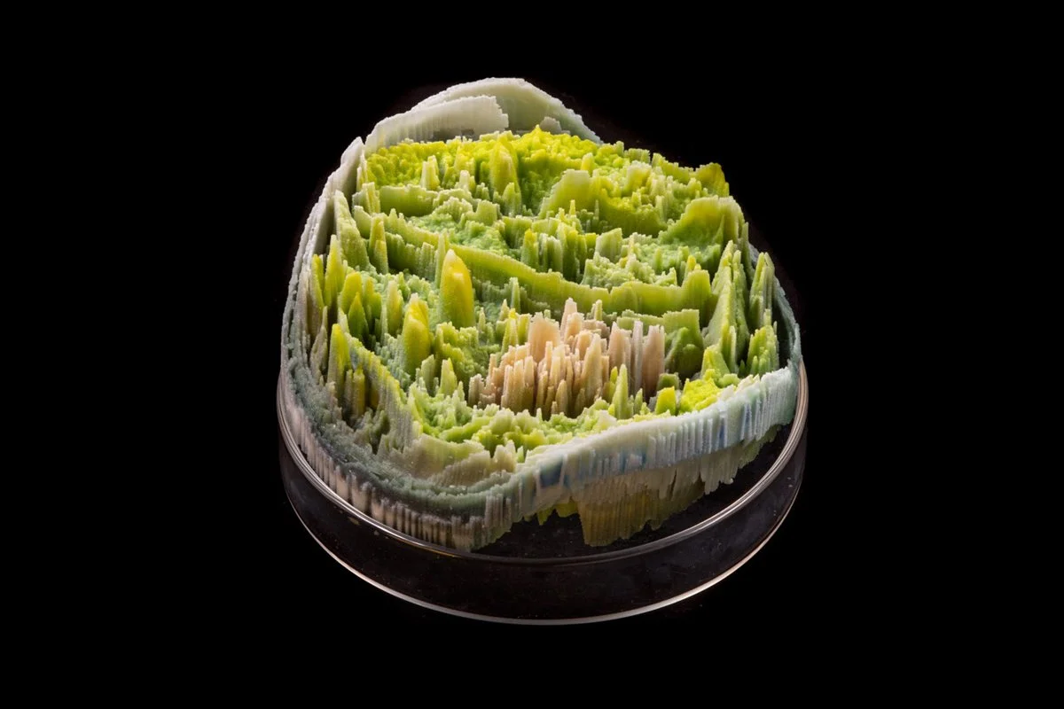
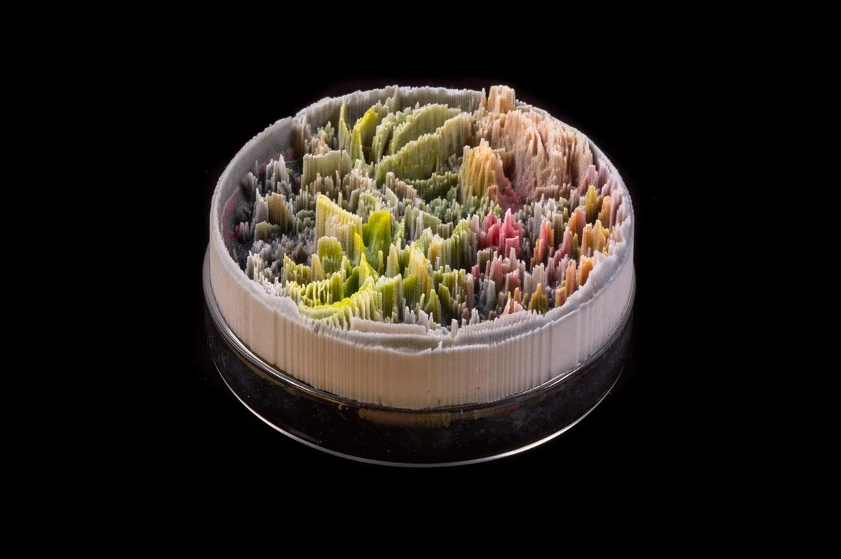
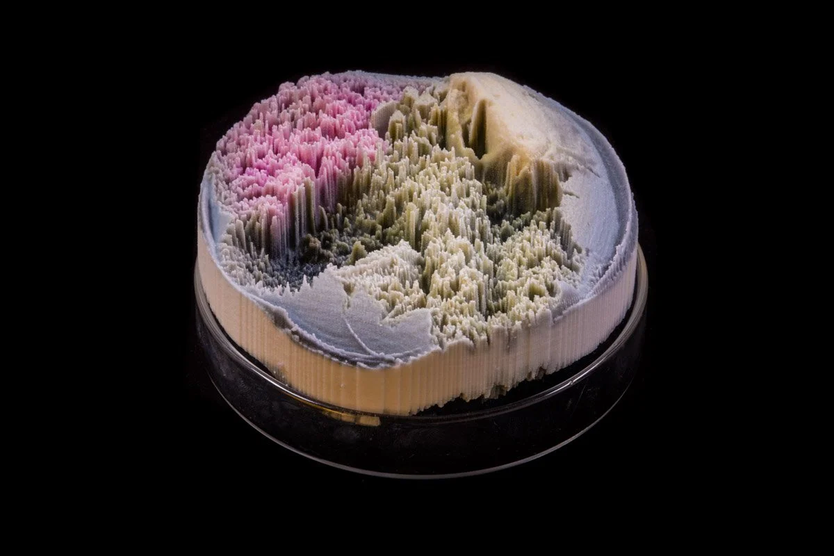
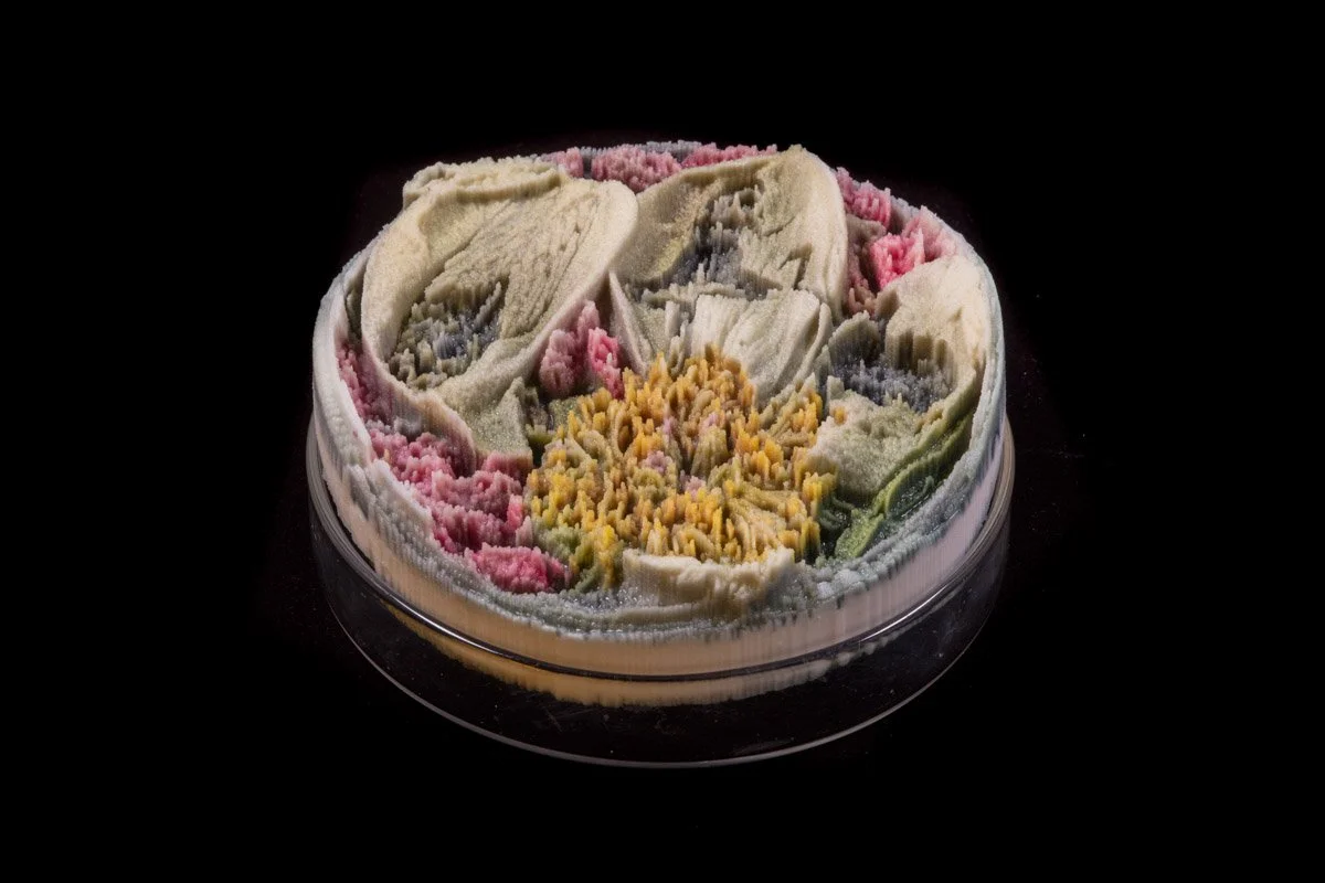
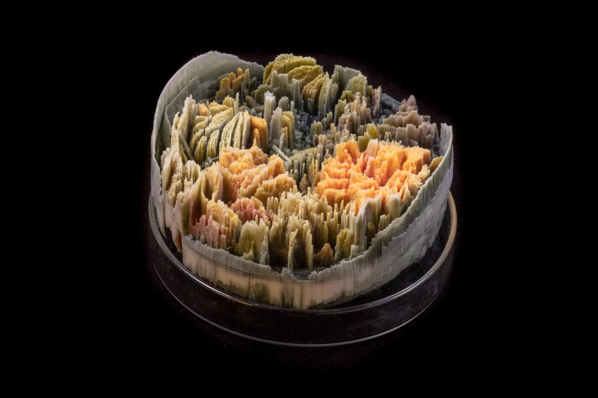
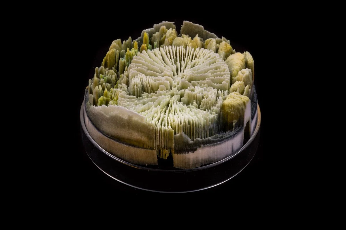
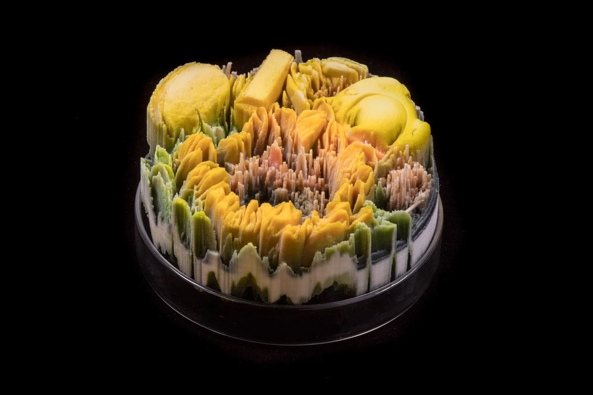
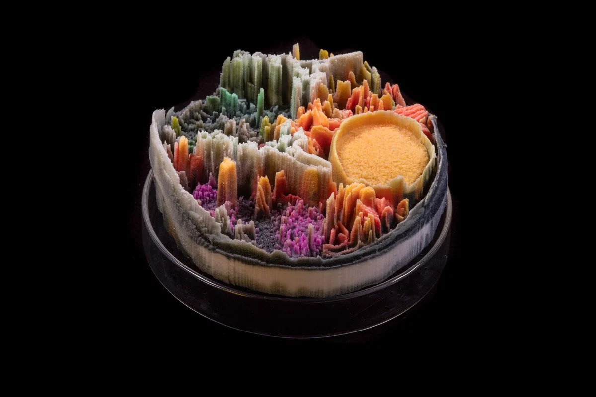
Remote Sensing (2013 — ongoing) is a series of rapid prototype sculptures appearing as micro-landscapes. Produced with a 3D printer employing pigmented plaster and resin, the work takes its cue from the disastrous impacts of toxicity and war. The title of the project “Remote sensing” originated from a term used in satellite technology to describe computer-generated data used to assess geographical areas that are too problematic or dangerous for human intervention.
Fabrication begins with the digital photographs from the “Vanitas (in a Petri dish)” series. Computer programs reprocess these high-resolution images, converting the photographs’ color arrays into 3D protrusionsa technique called displacement mapping. The resulting objects take on new meanings as a still life is transformed into a micro-landscape, offering new pictorial configurations in both science and art.
Classification
Ceramics, Sculpture & Installation
Medium
Acrylic paint and inks, plaster, pigment and resin, glass Petri dishes
Dimensions
4 × 4 × 2″ each; installation variable
Photo Credit
Photo by: Raul Valverde / onwhitewall.com
Remote Sensing #01
Remote Sensing #04
Remote Sensing #07
Remote Sensing #12
Remote Sensing #13
Remote Sensing #15
Remote Sensing #26
Remote Sensing #28
Remote Sensing #36
Remote Sensing #38

Remote Sensing #42

Remote Sensing #47